
Behold the The MiddleEarth DEM [Digital Elevation Model] Project. Via io9, we learn:
The Middle Earth Digital Elevation Model Project is a collaborative effort to create a complete digital model of Middle Earth that can be virtually explored on foot or admired from great heights. The worldbuilders are using the Outerra graphics engine to place every forest, field, and stream on their digital Middle Earth and you can download the demo version of Middle Earth—DEM that they released last year. You can also read more about the project in the Outerra and Cartographers’ Guild forums.
Here’s Mordor on the bottom right and Gondor on the bottom left, with the Anduin flowing from the Misty Mountains at the top center:
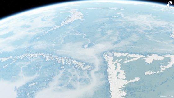
(Click here for a larger version.)
A sort of upside down angle on the Blue Mountains and Ered Luin, with the Shire to the left of the curved snow-covered mountains (circled in red):

(Click here for a larger version.)
Another angle on Mordor and Gondor:

(Click here for a larger version.)
These give me chills!
Many more images at The MiddleEarth DEM Project.


Once you have a DEM (plus climate data), you can do all sorts of other fun stuff too. Modelling water flows and the effects of sea level change. Building a simulated transport network. And so on…
They should make some satellite photos (like these) with a slider that you can move left or right to compare images of, say, Isengard pre- and post-forest-uprooting, or pre- and post-Ent attack, or Mount Doom before and after cratering.